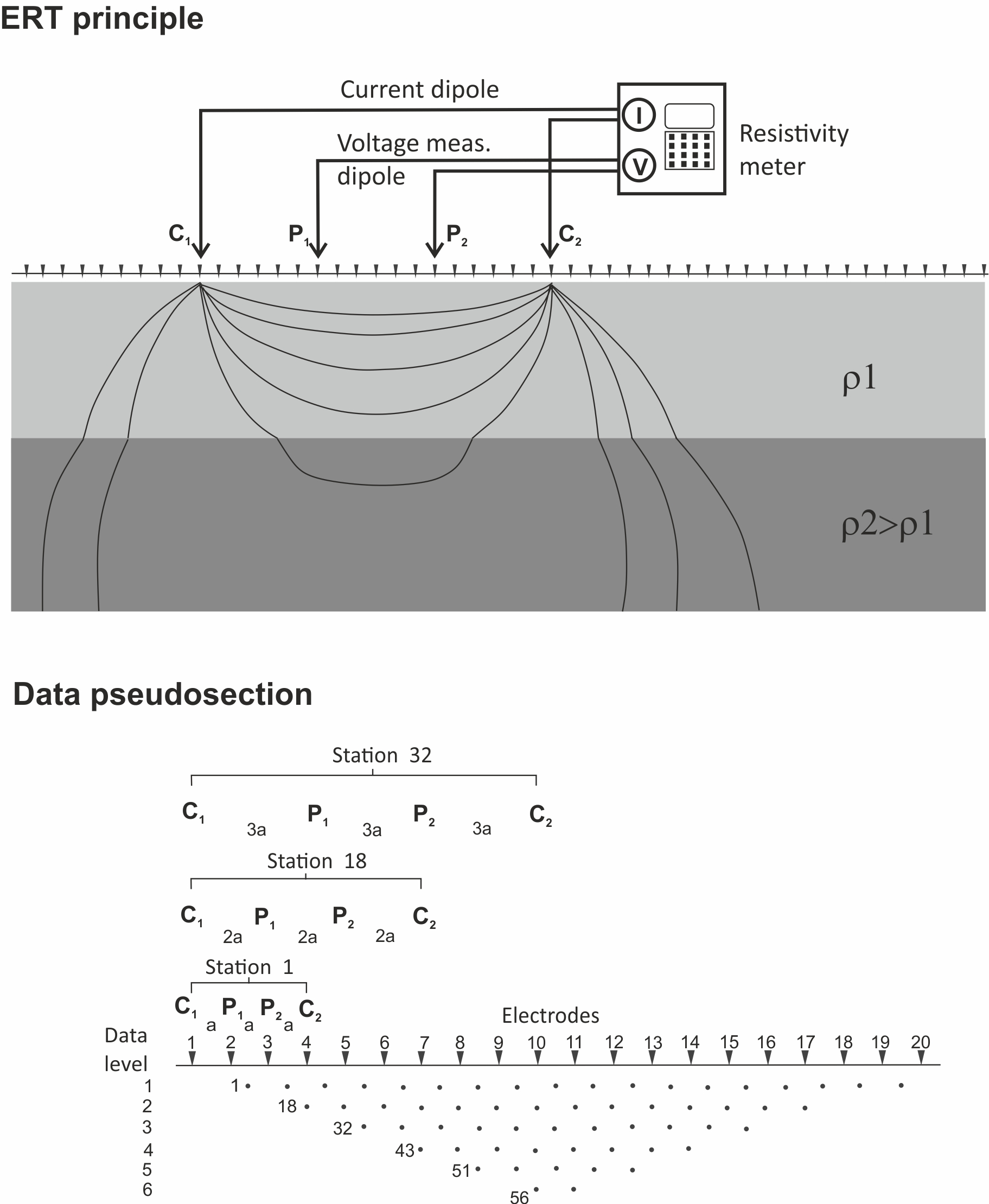
- Geoelectrical techniques are aimed at characterise the electrical properties of the Earth, such as resistivity and chargeability; chargeability can be thought as a measure of its capacitive response.
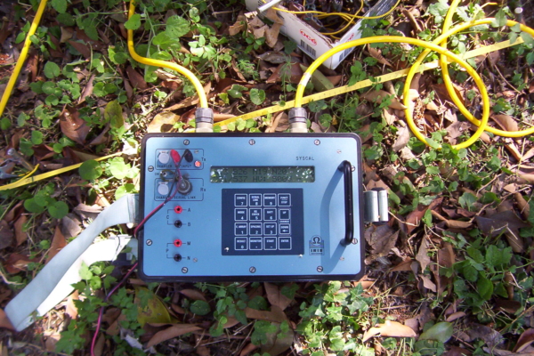
- Electrical measurements are taken by a measurement dipole, after voltage is applied to the ground by means of a current dipole. The measured resistances are recorded and stored by a data logger. The resistances are then converted to apparent resistivity through a geometrical factor depending reciprocal position.At the same time, the voltage time decay is measured in order to evaluate the chargeability of the ground. The correction for telluric currents are automatically performed by the equipment, by periodically changing the voltage polarity.
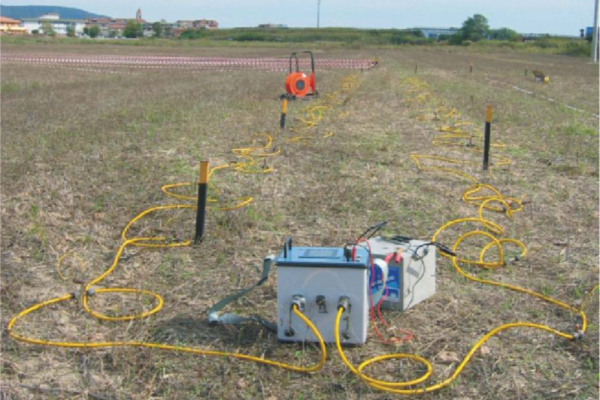
- The nowadays standard approach to get reliable 2D and 3D geoelectrical imaging, is based upon the multielectrode technique, by means of which it’s possible to simultaneously measure resistivity and chargeability by means of different dipoles.
- Such method is called “Electrical Resistivity Tomography” (ERT), since it allows to depict “slices” of resistivity (and chargeability).
- In an environmental prospect, resistivity and chargeability anomalies are often related to the presence of polluting fluids, like hydrocarbon-contaminated waters, or waste site leakage. The anomalies can also be used to identify metallic wastes, like steel drums.
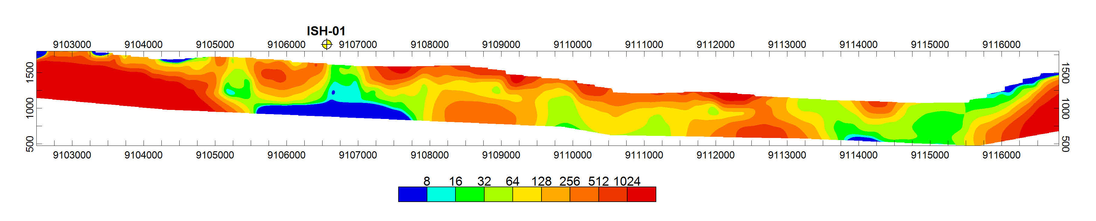 |
| ERT for a geothermal field investigation |
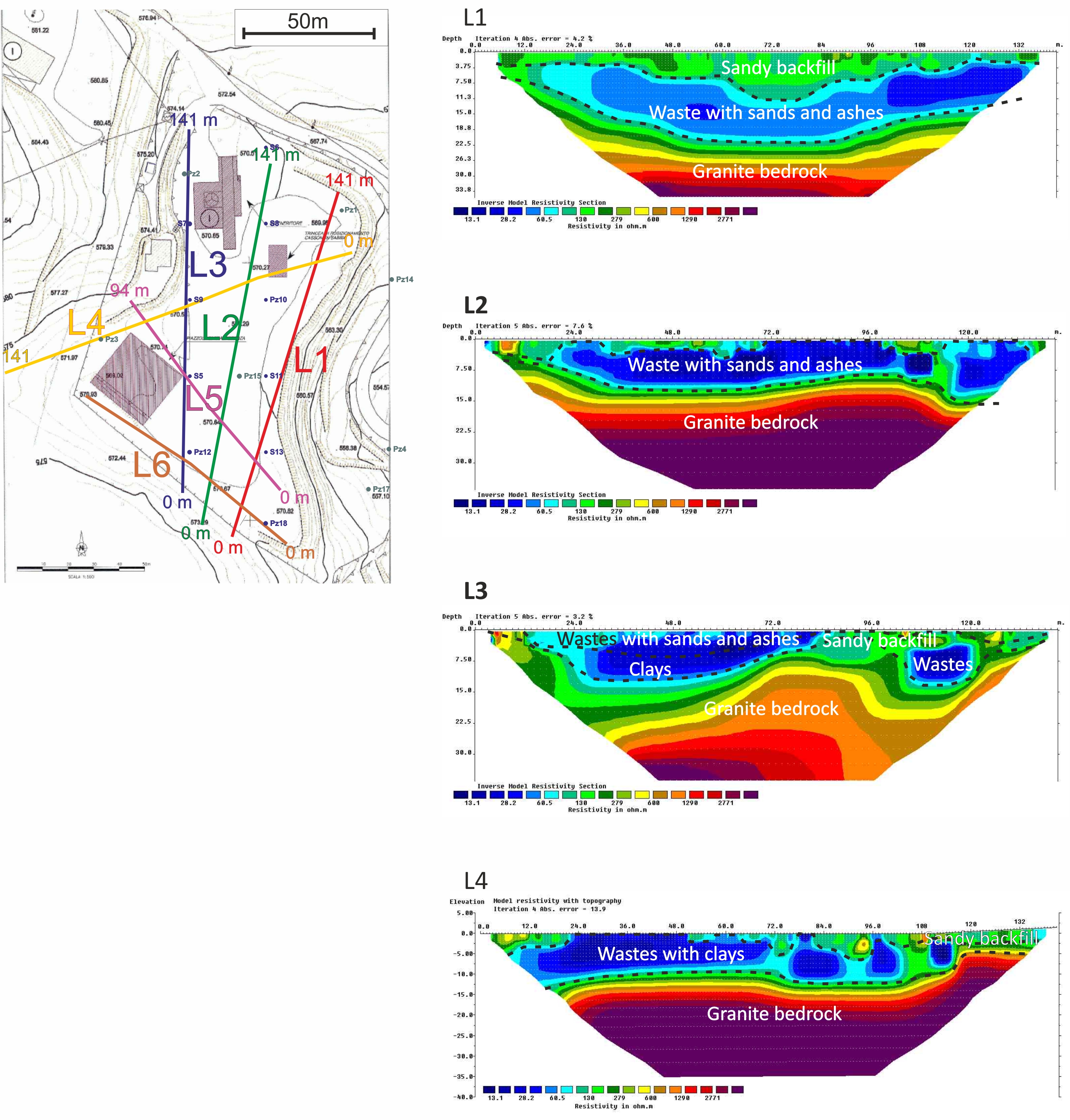 |
| ERT for a waste disposal site investigation |
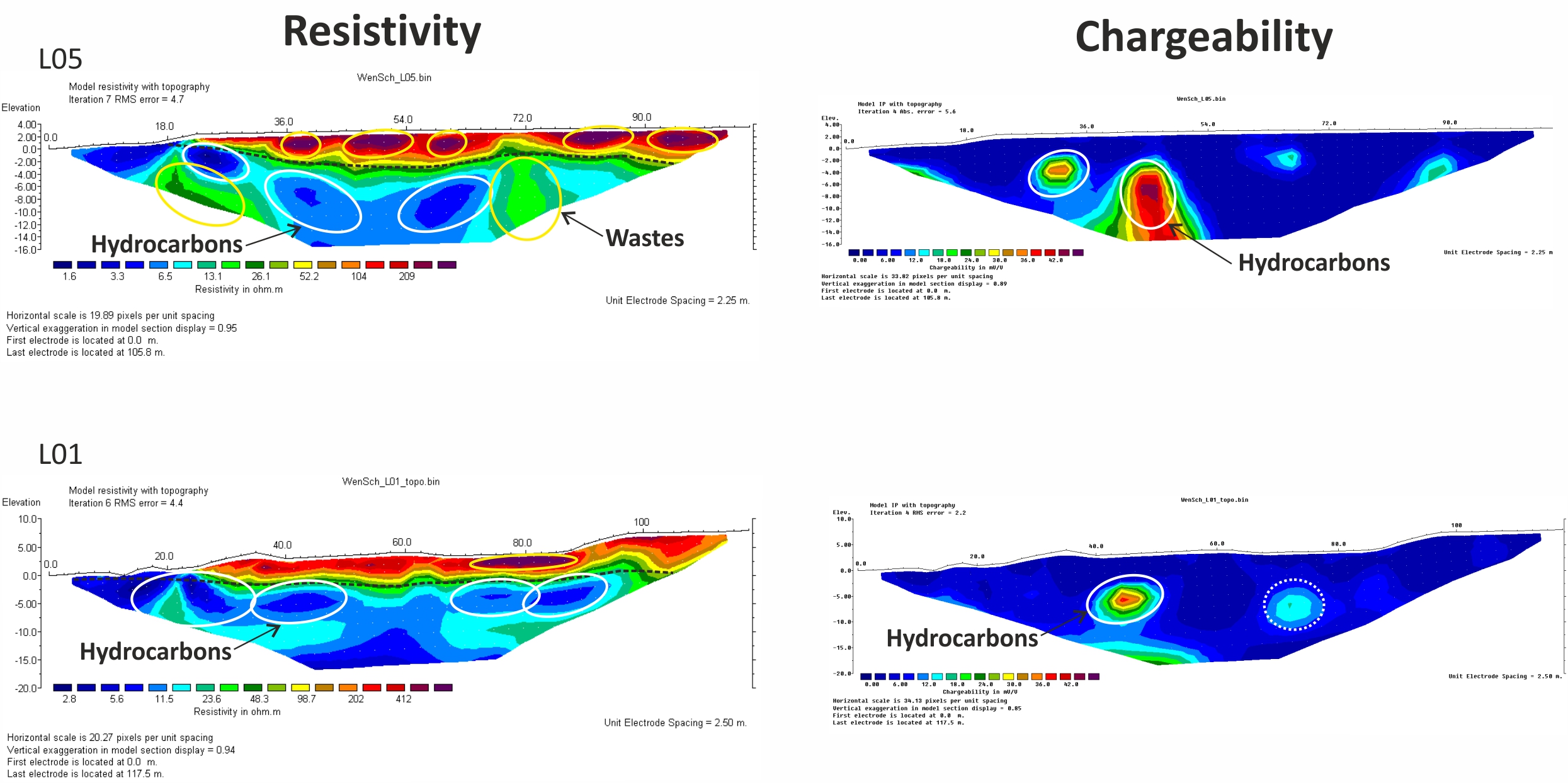 |
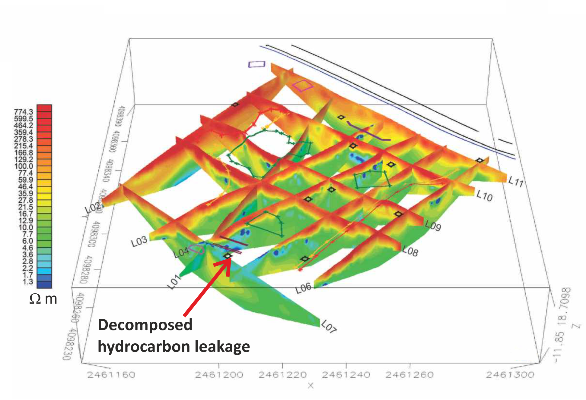
| ERT and IP survey for hydrocarbons plume detection. |
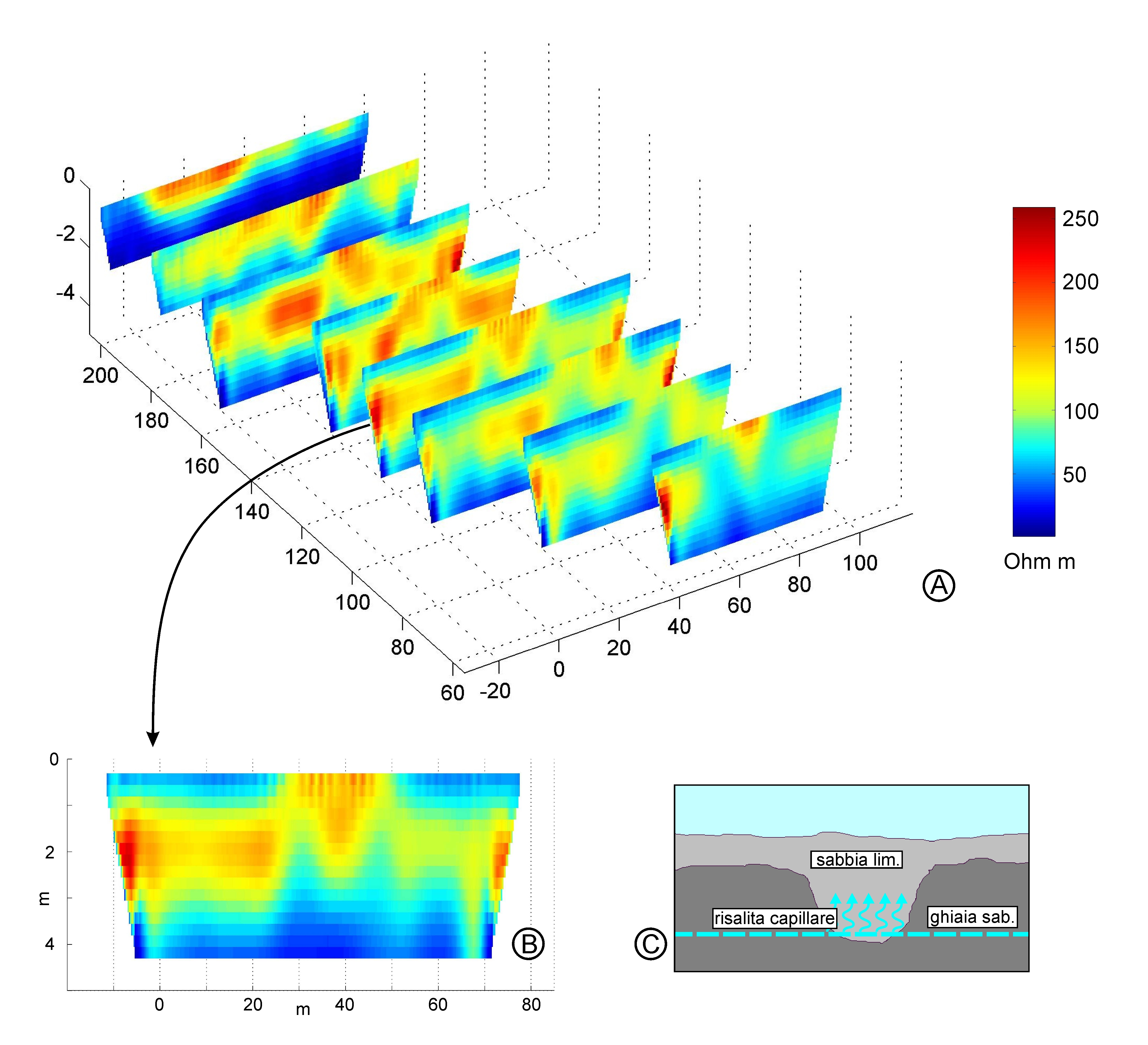 |
| ERT for hydrogeological investigations |
 |