
- Magnetometry allows to identify the Earth’s magnetic field anomalies produced by bodies or structures having anomalous magnetic susceptibility respect to the hosting rocks.
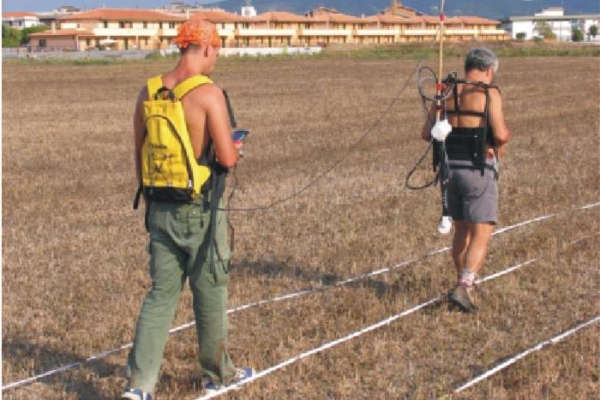
- Magnetic data are measured at the surface usually along profiles, by means of total field or tri-axial magnetometers. The magnetic data are first corrected for the diurnal variation correction, caused by external field intensity changes, and then for the main field variation, according the IGRF data.
- Magnetic data analysis is initially carried out from magnetic maps, after data reduction. From magnetic maps is possible to locate the anomaly sources, through the use of specific mathematical tools, derived from field’s gradient. Subsequent data processing can include source depth estimation and 2D/3D Susceptibility modelling.
- Magnetic susceptibility is related to a great variety of geological processes and minerals, thus being an important tool to constrain geological hypothesis, like presence of faults, contacts between rock formations, and orebodies. Anomalous magnetic properties are also possessed by anthropogenic objects of ferromagnetic material, that constitute a good target for this geophysical method; it’s for these reasons that magnetometry is a powerful tool in wide waste-site investigation.

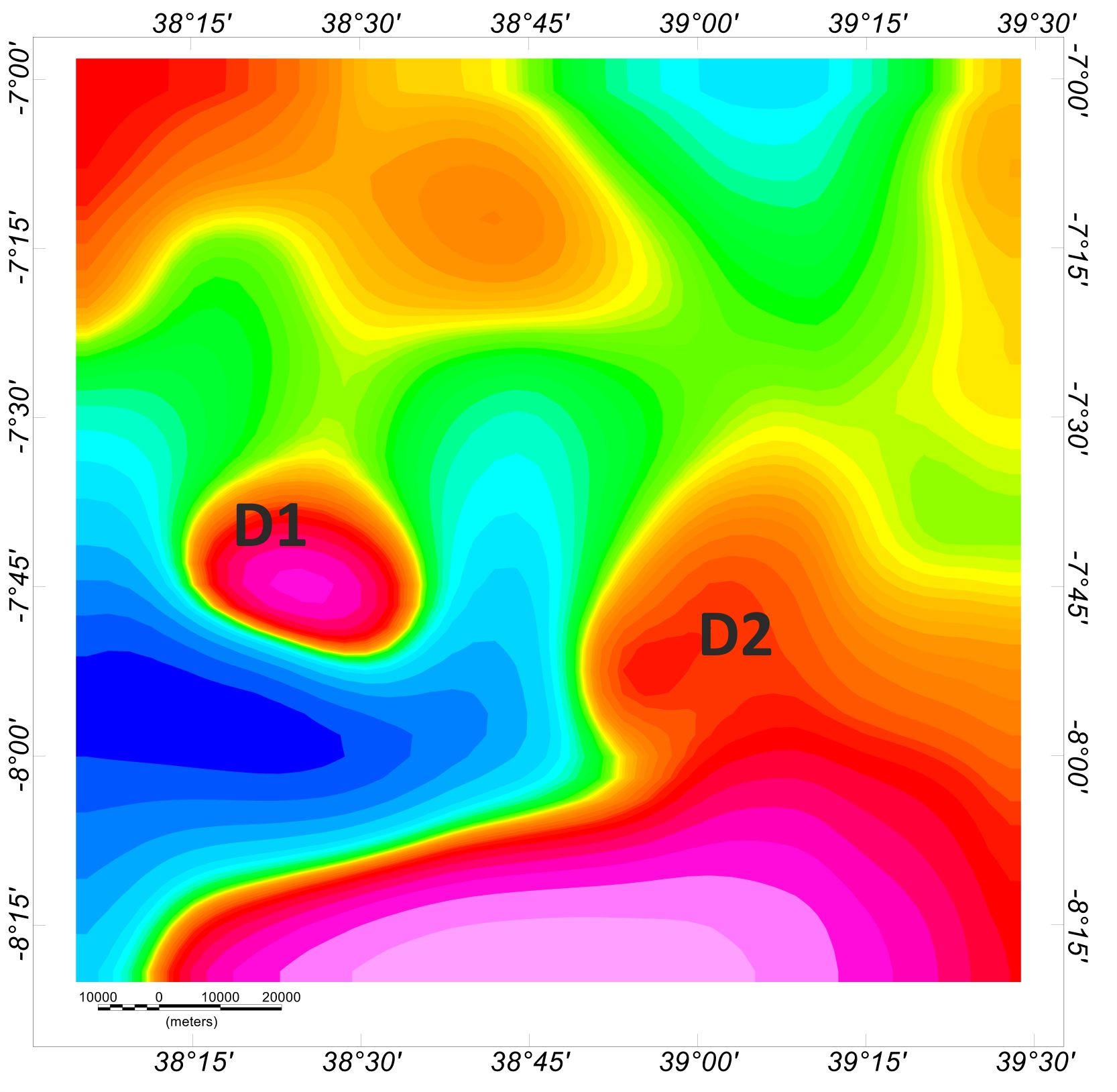 |
| Magnetic raw data over regional scale |
 |
 |
| Vertical magnetic field gradient mapping for archaeological researches |
 |
| EMAG 3D modelling for hydrogeological investigations |
