

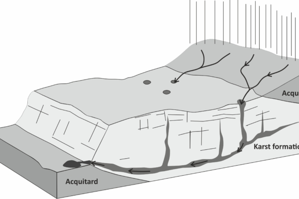
Sketch view of a karst system hydrogeology
Scientific issues
-
Fresh groundwater availability is today a world-scale pressing need, and the exploitation of groundwater resources plays a key-role for the next future of our planet. Thus, it’s obvious that accurate and reliable location methods are of primary importance in the decision-making of water research.
-
Sea coastal acquifers are constantly threatened by saltwater intrusion, and they will be even more in the future, given the foreseen sea-level rise. The identification of the fresh/salt water interface thus can be an important factor in land use planning.
-
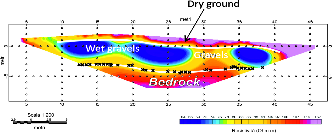
Presence of water primarily alters the bulk electrical properties of the rocks and soils, according to the porosity, structure, cementation, saturation and its resistivity.
-
Water-bearing rocks also are affected by a variation in their bulk mechanical properties, leading to variations in their seismic velocities.
-
Moreover, the presence of faults and cavities (such as karsts) have a dramatic impact on the water underground propagation and accumulation.
-
Nowadays geophysics can be a reliable tool to locate groundwater resources, that can greatly aid the standard geological surveys. Our company offers high-technology water research services, carried out by means of by state-of-the-art geophysical equipments and a consolidated experience.
Geophysics’ contributions
-
Multidimensional (2D/3D) resistivity imaging aimed at reconstruct the water table surface (carried out by means of ERT and TDEM measurements)
-
Multidimensional (2D/3D) density modelling and location of the main structural lineaments and karst detection from the measured gravity field
-
Water-bearing faults location in crystalline rocks by VLF measurements
-
Identification of bedrock surface by seismic surveys

 |
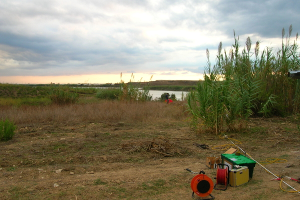
| ERT survey for the study of coastal saline wedge intrusion in a sandy coastal acquifer. |
 |
| 3D resistivity model of the saltwater wedge intrusion. |
 |
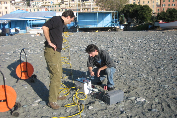
| ERT survey for groundwater location. |