
- The heterogeneous density distribution of the Earth produces spatial changes in the observed gravity field, however most of the field variations are produced by density heterogeneities occurring in the crust.
-
The objective of any gravity surveys is to reconstruct the Earth’s gravity field over a given area of interest, and to identify its anomalies. These anomalies can be a few millionths of the average Earth’s gravity field, and high-resolution instruments and accurate procedures are necessary. Gravity measurements must also be associated with high-precision differential GPS measurements.
-
After the raw gravity data are corrected for instrumental drift, tide, elevation, density, topography and barometry, they are analysed through the use of specific mathematical tools, derived from field’s gradient, and modelled by 2D/3D forward and inversions.
-
The data analysis and modelling may reveal important geological and structural features from local to regional scales, according to the surveyed area extension.


 |
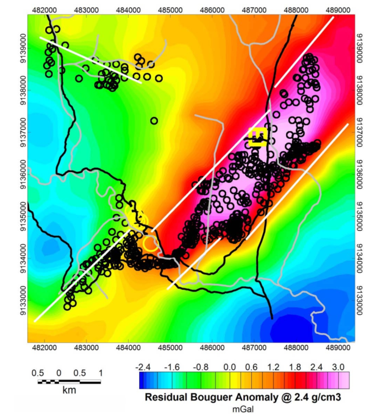
| Complete Bouguer anomaly map |
 |
| Source location by 3D Eulerian deconvolution |
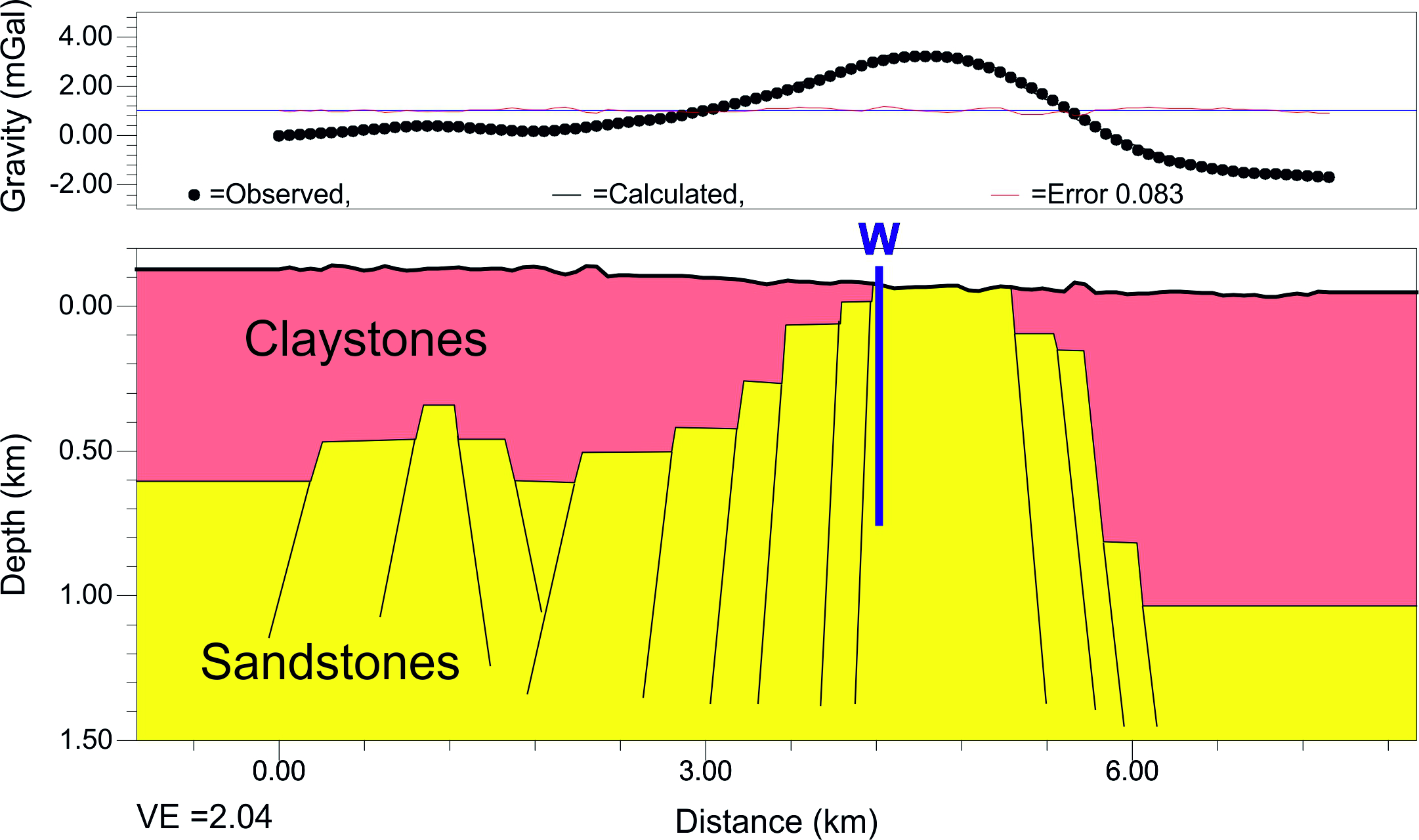 |
| Density modelling of the Bouguer anomaly |
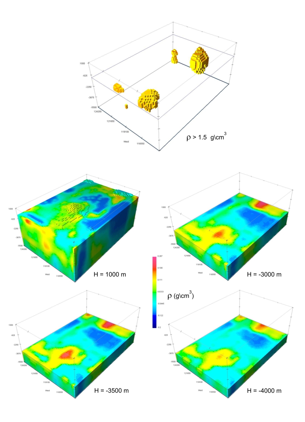 |
| 3D density inverse modelling |
